CCTV News:The increase of rainfall in summer is easy to cause natural disasters. Nowadays, with the progress of science and technology, more and more monitoring equipment helps people to perceive disasters in advance, and can quickly respond to grab more time to avoid danger through early warning. Today’s "Driving Force of Science and Technology" reveals how to use the power of science and technology to early warn the occurrence of geological disasters. Let’s look at a news scene first.
Not long ago, affected by continuous rainfall, the automatic monitoring equipment for geological disasters installed in Mudong Village, Jingde Town, Debao County, Guangxi triggered an early warning, and the geological monitors in Mudong Village immediately reported the situation to the County Natural Resources Bureau. According to the urgent judgment of technicians, there is a great possibility of debris flow at this hidden danger point, and it is immediately suggested that Jingde Town Government organize the evacuation of 41 people from 15 threatened households.
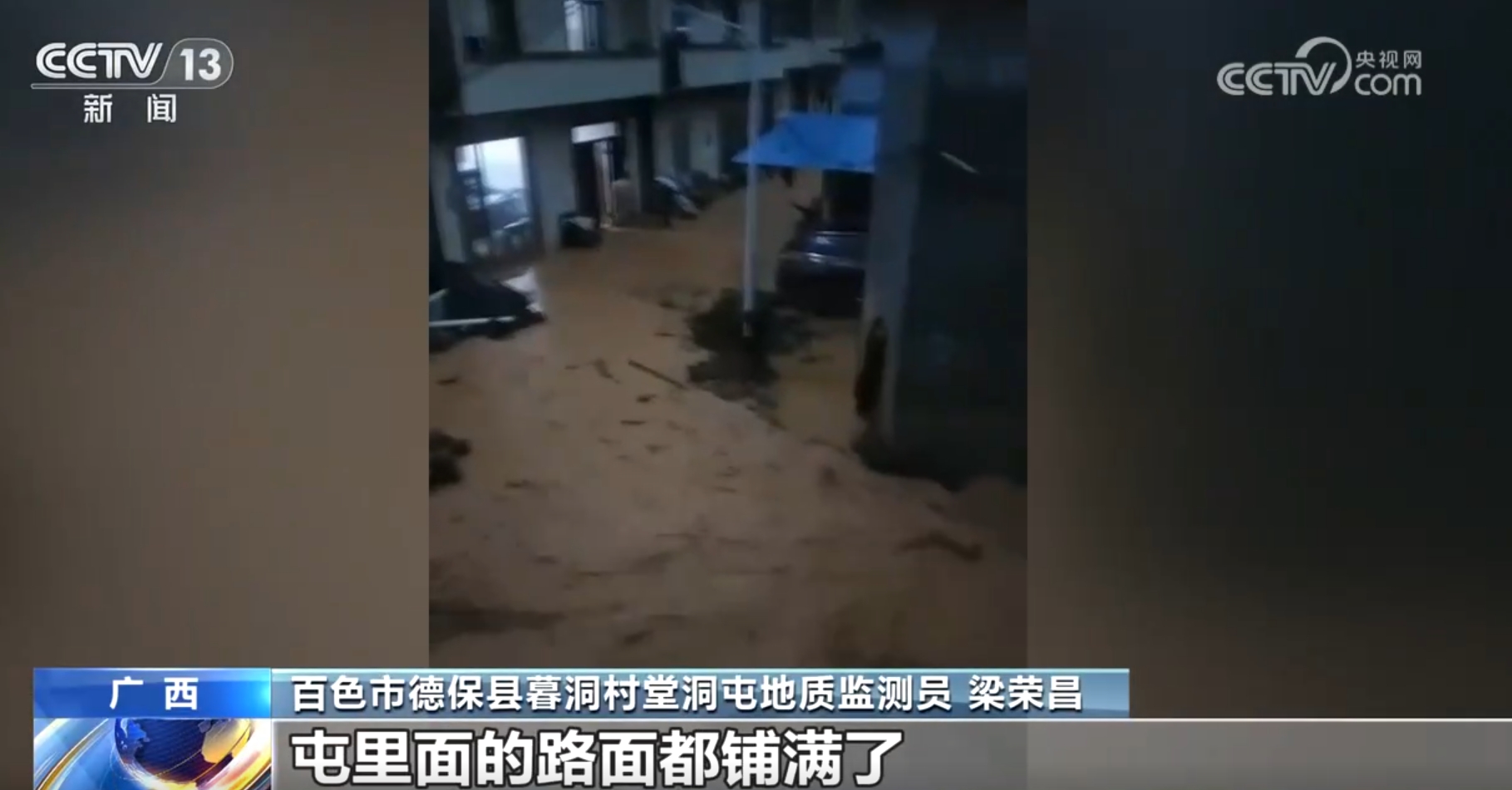
Liang Rongchang, a geological monitor of Tangdongtun, Mudong Village, Debao County, Baise City, Guangxi Province, recalled: "After the evacuation, it took about 10 to 20 minutes, and the mudslides came out, and the roads in the tundra were covered."
Wang Zhi, secretary of the party branch of Naliaotun, Mudong Village, Debao County, Baise City, Guangxi Province, said: "Fortunately, there was an early warning to evacuate quickly that day, so no casualties were caused."

The mudslide caused damage to nine houses. From 19: 10 on the same day to 19: 30, the mudslide occurred. Due to the timely warning, it won valuable 20 minutes for the evacuation of the people and avoided the possible casualties of 18 people in 9 households.
Combining technology with civil air defense to avoid casualties caused by geological disasters
In addition to debris flow, landslide is also a common geological disaster. According to the statistics of the Ministry of Natural Resources, among all kinds of geological disasters, landslide disasters caused by rainfall account for about 70%. The time window from receiving early warning to disaster occurrence is usually very short. How to effectively evacuate the people in the hidden danger area in a short time and avoid casualties to the maximum extent? Let’s look at a case that happened in Yunnan not long ago.
One morning not long ago, Zhao Hai, a geological monitor in Nongbing Village, Xishan Township, mangshi, Yunnan Province, received a disaster warning of a hidden danger point in the village. He immediately investigated the hidden dangers in the village and found that there was a great possibility of disasters.
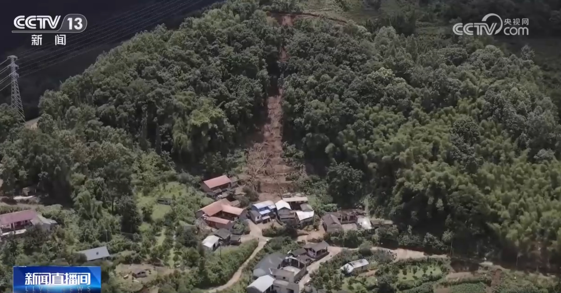
The monitor knocked on the door while knocking on the gong, and the person who received the notice quickly informed the next household to move the person to a safe place. At about 6: 20 in the morning, all the villagers evacuated safely. Twenty minutes later, the landslide happened.
The danger is imminent. How can people who are still asleep be evacuated quickly? At this time, mangshi’s "ten-household" grid mechanism played a key role. Before the flood came, Nongbing Village organized the masses to move to avoid danger in groups of ten households according to the principle of "living adjacent to each other and easy to concentrate", and the village also conducted emergency evacuation drills in advance.
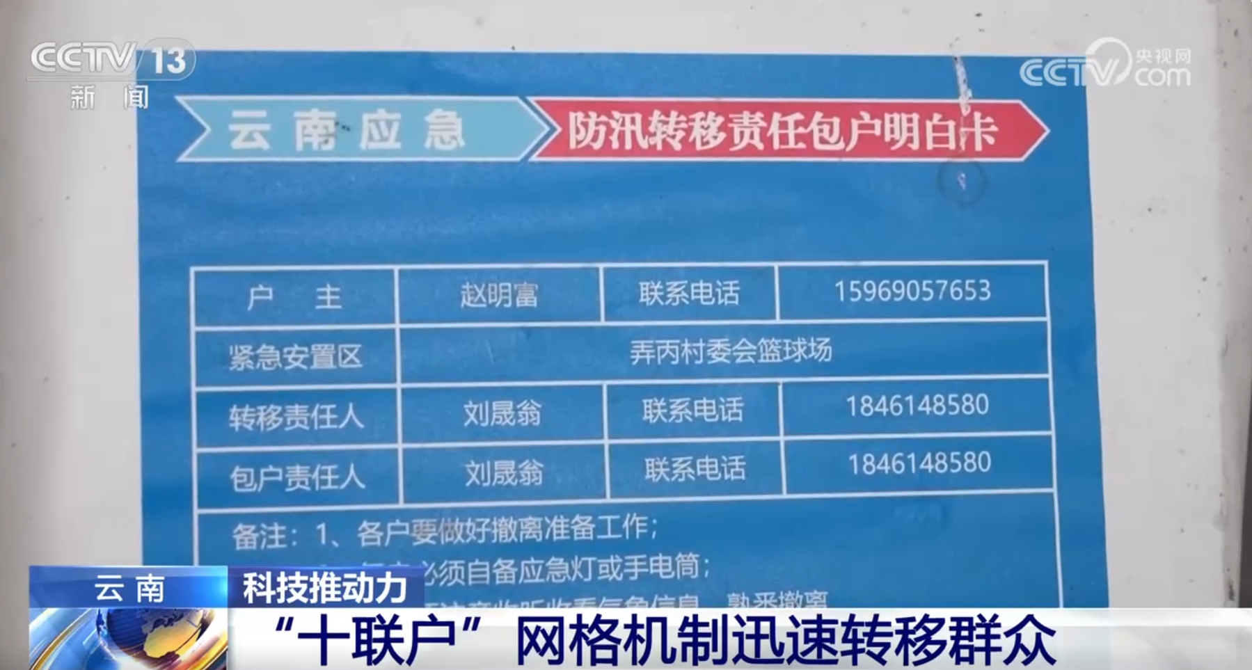
Cun Daihua, secretary of the Party Committee of Xishan Township, mangshi, Dehong Prefecture, said: "We mainly put ‘ Ten households ’ Blend in After notifying one household, everyone else will be responsible for notifying the next household, which greatly shortens the time. "
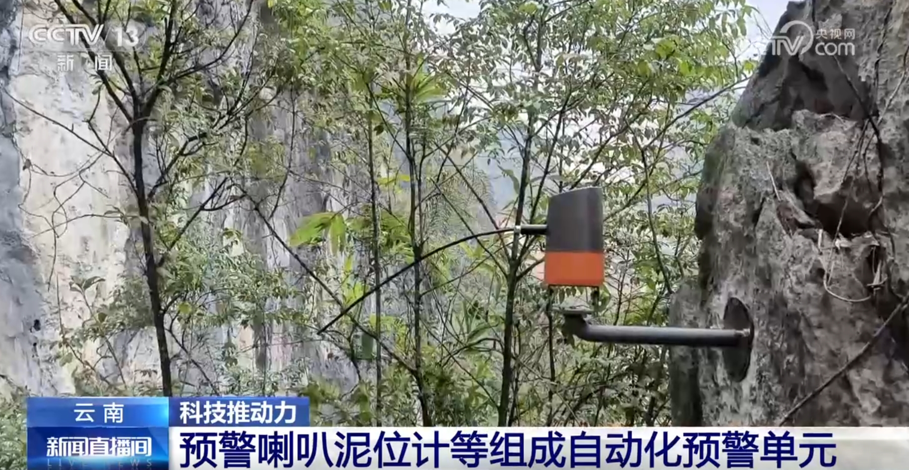
Because of proper measures, all 34 people from 17 households in the village were successfully transferred, avoiding casualties. The monitoring and early warning equipment in Nongbing Village consists of multiple instruments, and the early warning horn and mud level meter installed in the debris flow ditch form a small automatic early warning unit.
Zhao Hai, a geological monitor, said: "The four sets of equipment installed in our stockade have brought us the benefits of accurate forecasting, so that ordinary people can quickly evacuate to a safe place."
Mud level meter detects the change of river bed height and transmits data.
Affected by global climate change, in recent two years, severe weather has occurred frequently, and the prevention of geological disasters is facing greater challenges. In extreme weather, how various monitoring and early warning technologies respond quickly and grab more hedging time has attracted much attention. The mud level meter mentioned in the news just now can detect the change of river bed height and achieve the purpose of early warning, and this equipment has also been put into use in Guangxi.
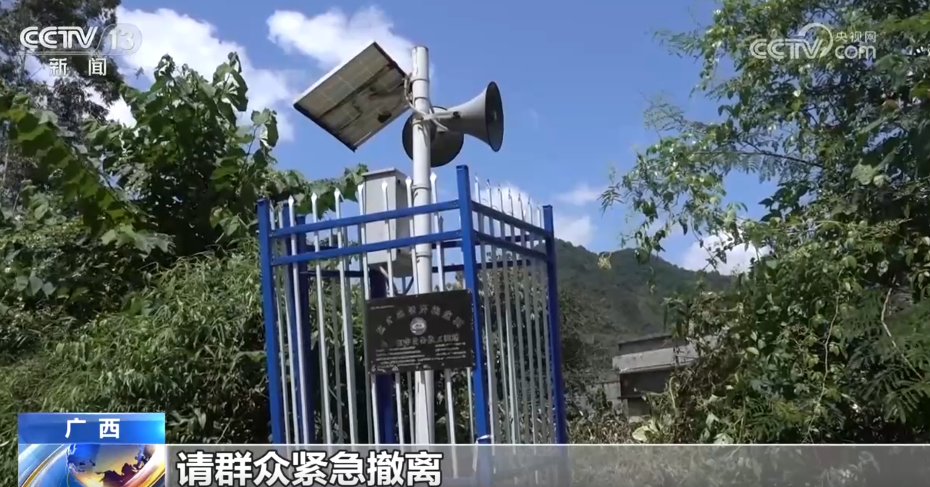
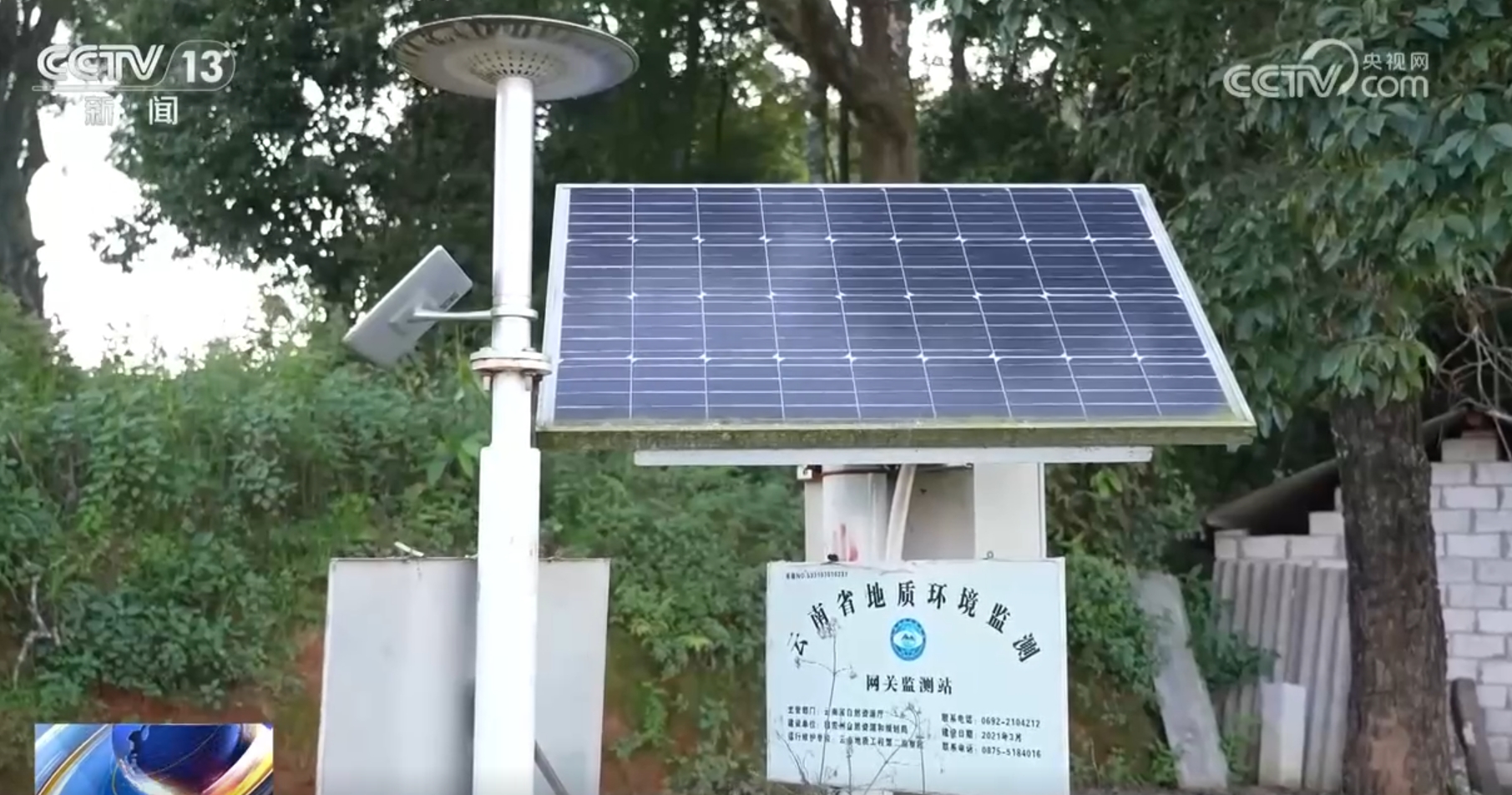
In recent years, the natural resources department of Guangxi has specially installed automatic monitoring and early warning equipment in some hidden danger points of geological disasters with serious danger. On a hillside in Mudong Village, Debao County, Baise City, an early warning equipment mud level meter is installed, which can predict the possibility of debris flow disaster in advance. The mud level meter is also connected to the emergency warning horn below the hillside to inform the villagers to evacuate in time.
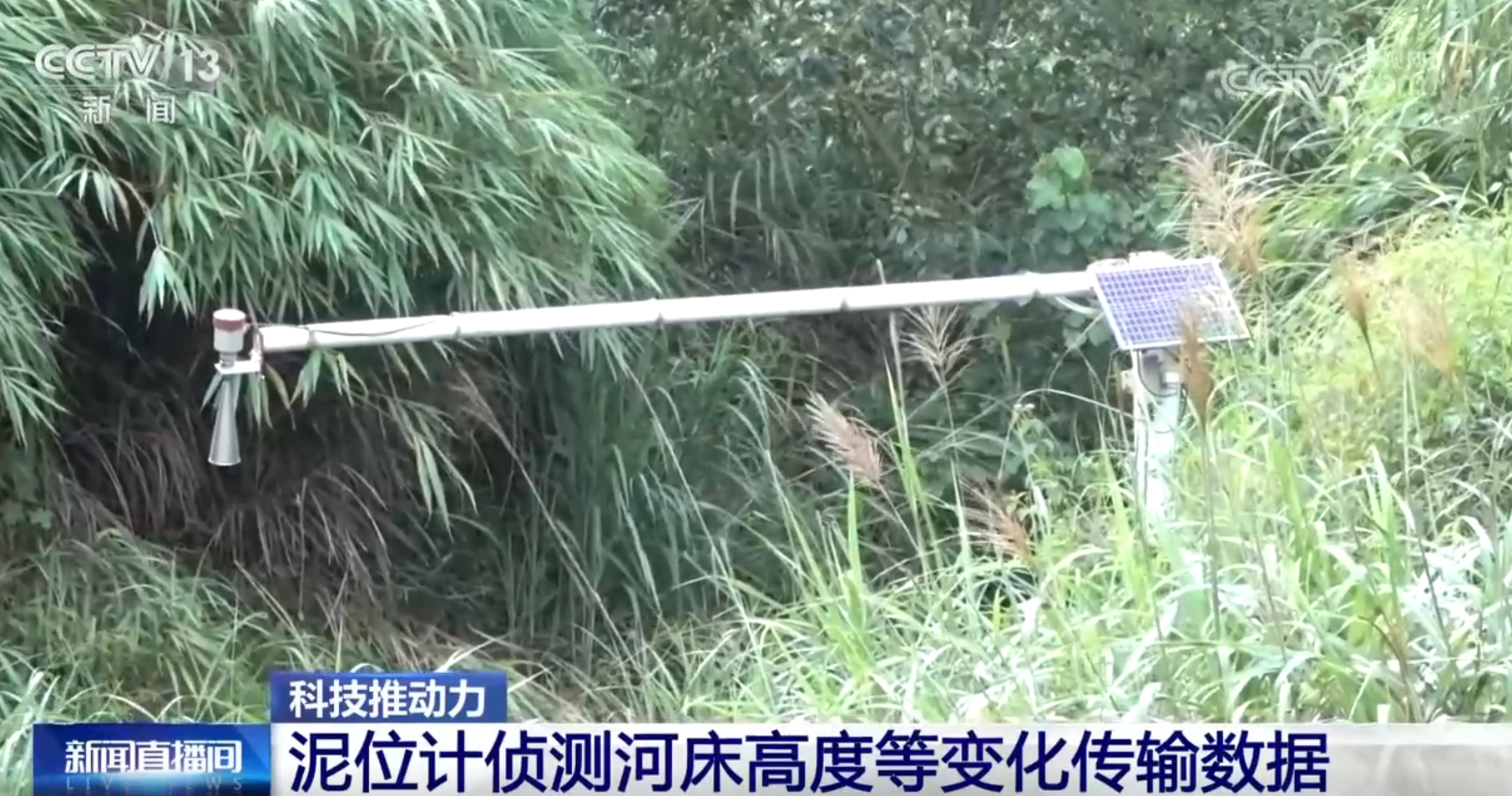
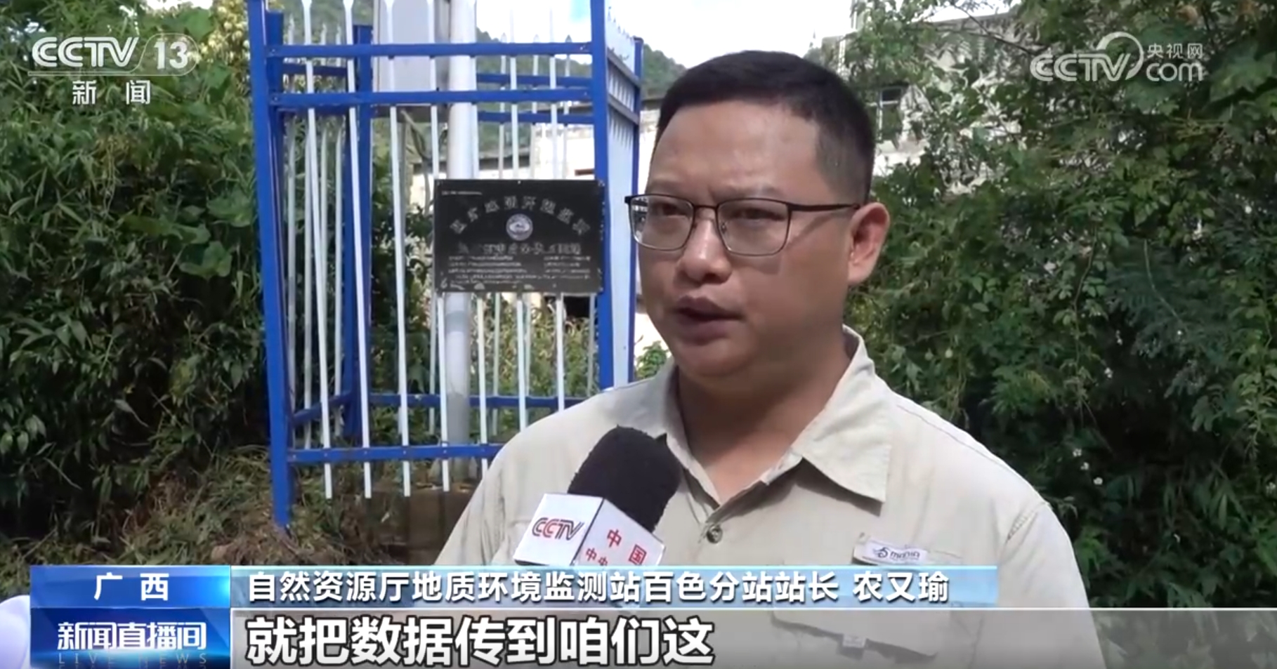
Nong Youyu, director of Baise Sub-station of the Geological Environment Monitoring Station of the Department of Natural Resources, said: "The mud level meter is a set of equipment specially developed for the geological disaster of debris flow. Its main principle is to monitor whether there is siltation and accumulation in the debris flow ditch, as well as to detect the change of riverbed height. After monitoring that the rainfall is relatively large and there are some signs of deformation, the monitoring equipment on the mountain will transmit the data to us. "
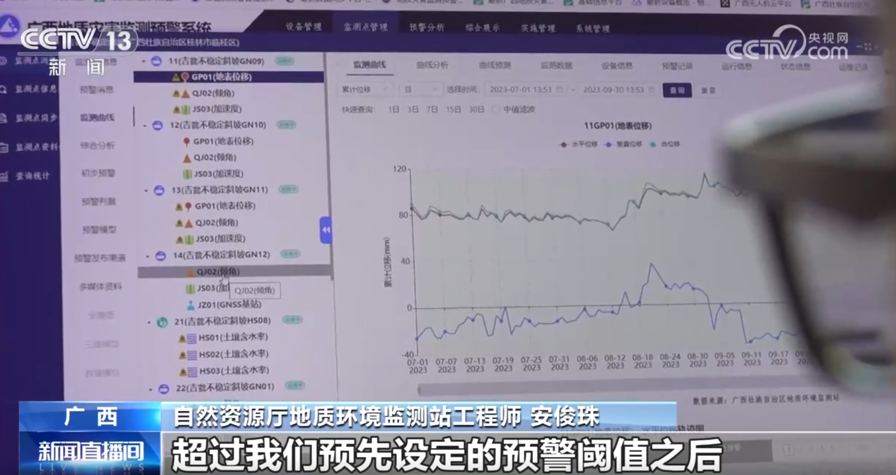
An Junzhu, an engineer of the Geological Environment Monitoring Station of the Department of Natural Resources, said: "This is a geological disaster monitoring and early warning system in Guangxi. It mainly manages all 3,470 monitoring stations, and more than 22,000 monitoring equipment are all included in the system management. After the monitoring equipment in the field collects the data, it uploads it to the background server. Once this data changes beyond the preset warning threshold, the platform will generate early warning information to remind the people to evacuate urgently. "
The reporter asked: "How long does it take from discovery to system response to early warning broadcast?"
An Junzhu replied: "Generally, it is 20-mdash; 30 seconds. "
At present, China is promoting the scale and industrialization of monitoring instruments and equipment. In recent years, the automatic monitoring equipment developed has higher integration and reliability.
Zhangming, director of the Geological Disaster Technology and Method Office of China Geological Environment Monitoring Institute, said: "All the instruments we have developed at present are constantly iteratively upgraded, and the cost of comprehensive monitoring of geological hazards has dropped to about 100,000 yuan."
At present, the Ministry of Natural Resources has deployed 280,000 sets of automatic monitoring equipment nationwide, covering 59,000 geological hazards. Through scientific early warning, 68 disasters have been successfully predicted this year, avoiding 216 possible casualties.
Active prevention and control of hidden dangers of major disasters by integrating "space and heaven"
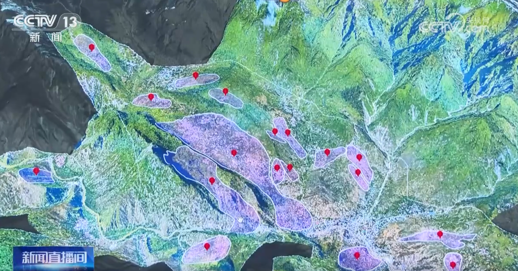
In addition to achieving the purpose of early warning through automatic early warning and monitoring equipment, in recent years, through satellite, unmanned aerial vehicle and ground investigation, China has built an integrated remote sensing monitoring technology system for hidden points of geological disasters, realizing the active prevention and control of major disasters.
Since 2020, China has completed the identification of hidden dangers in 713 counties with 4.07 million square kilometers in high-risk and prone areas of geological disasters through advanced observation methods such as radar satellites, optical satellites and aerial remote sensing, lidar and drone remote sensing.
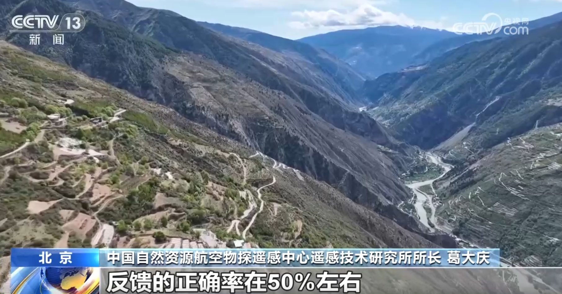
Ge Daqing, director of the Institute of Remote Sensing Technology of China Natural Resources Aviation Geophysical Prospecting and Remote Sensing Center, said: "There are 35,890 suspected hidden dangers, and 15,000 of them have been verified on the spot. The correct rate of feedback is about 50%, and more than 4,200 of them are new and unknown in the past."
The application of satellite and aerial remote sensing is aimed at key targets.
Ge Daqing introduced: "The main focus is on some mountain and canyon areas, the threat of inaccessible people and complex ground investigation conditions, and these major hidden dangers of major facilities in villages and market towns."
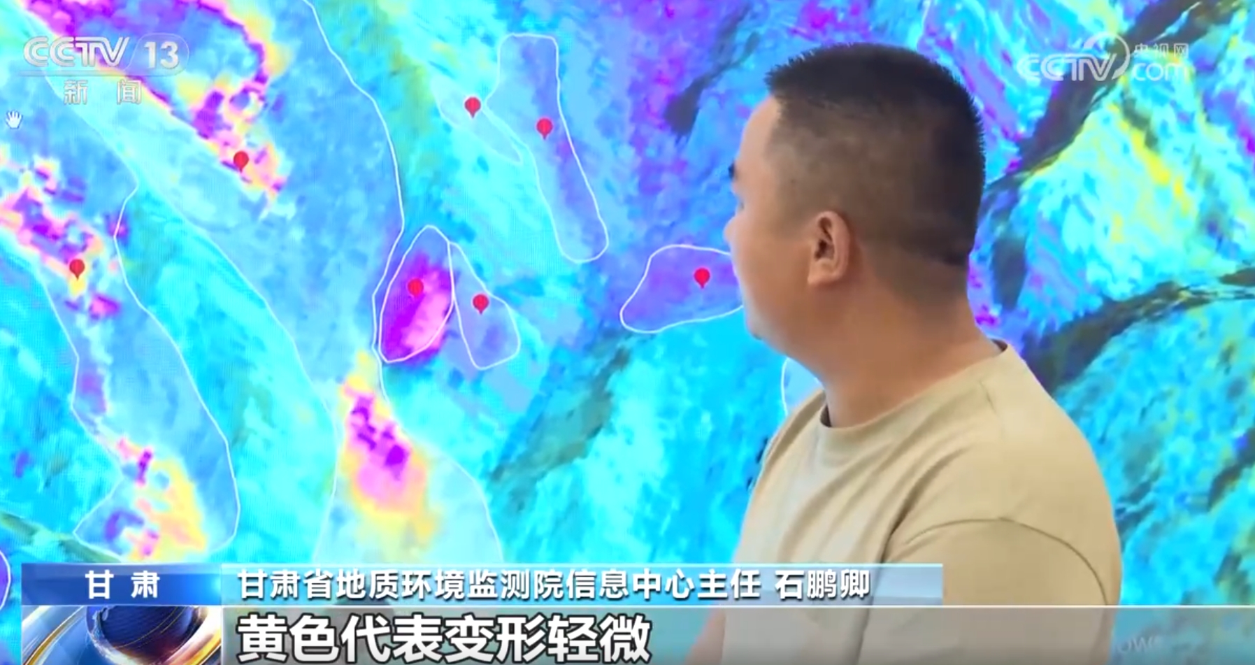
Due to the complex geological structure and prone to geological disasters, there are 21,896 hidden dangers of geological disasters in Gansu Province, ranking third in the country. In Gansu Institute of Geological Environment Monitoring, technicians use radar satellites running in low-earth orbit all the time to monitor more than 20,000 hidden danger points of geological disasters in the province 24 hours a day.
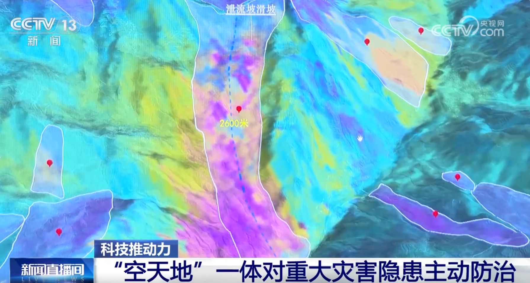
Shi Pengqing, director of the Information Center of Gansu Geological Environment Monitoring Institute, said: "We first obtained the surface deformation information by using radar satellites. Like this area, we can see that it has obvious deformation areas, with purple representing obvious deformation and yellow representing slight deformation."
Radar satellites can detect deformation, while high-resolution optical satellites can determine the range of hidden dangers. The 2-meter resolution satellite of "Gaofen-1" can judge the outline of large and extra-large landslides, and the range of landslides can be determined by combining the deformation information. Gansu has also achieved full coverage of 0.8-meter resolution optical images of key cities, and its ability to identify hidden dangers has been further strengthened.
The suspected hidden danger points seen on the satellite need further confirmation on the ground. In the past, geologists had to wade across mountains and rivers, measure landslides bit by bit and monitor hidden dangers on the spot. But now, a drone can take off and land several times to complete the work of the past few days.
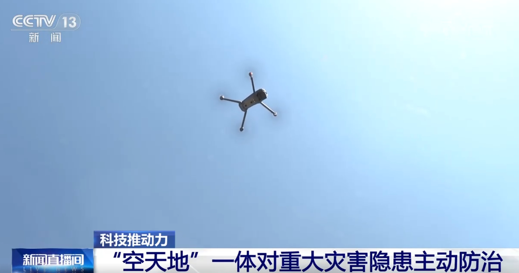
He Peng, a senior engineer of China Natural Resources Aviation Geophysical Prospecting and Remote Sensing Center, said: "We have done a lot of work in the early stage by means of remote sensing to avoid our personnel running around the mountains and reduce the workload, so that local experts can focus more on their goals and better realize the concept of people first and life first."